In this episode we will be roaming ancient structures of the people before us. Remember that as we visit ruins, we must respect the culture attached to ruins, they are sacred to the Indigenous people.
The first ruins we visited were actually only a couple of miles from the fairgrounds. The ruins were found on the Salmon (pronounced Sol-mon) family homestead.
BACK HISTORY: The ruins date back to the 11th century, influenced by the Pueblo in Chaco Canyon. Later the Chacoans, about 1280, abandoned this site and the Mesa Verde people moved in for about another 50 years. The pueblo people migrated elsewhere, leaving the pueblo go into ruins.
In 1874, Timothy O'Sullivan, famous for photographing Civil War battles, photographed the ruins, providing the first documentation of the site.
1877 saw about 160 acres become the homestead for Peter Salmon and his descendants. Part of the structures were from around 1898, when George Salmon lived on the homestead.
The reason the ruins are named for the Salmons was because of their efforts to preserve the ruins.
1957 saw a change-of-guard from the Salmon descendants to Charles Dustin. Mr. Dustin had problems with vandalism and looting, and eventually sold the land to the San Juan County Museum Association in 1969.
The Association contacted Dr. Cynthia Irwin-Williams, who directed two excavations, one in 1972, the second in 1978. The artifact discoveries allowed the museum to open in 1973.
Back on track now.
OWNERS OF THE HOMESTEAD
Visit: https://farmingtonnm.org/listings/salmon-ruins.
From the street it was hard to tell where the ruins were located:
Once visitors get into the parking lot and start walking to the building, they will get a glimpse of the ruins.Because of the weather we chose to walk the ruins first, then tour the museum.OUT THE GIFT SHOP DOOR
Getting to the ruins was a bit steep, and toward the end it was steep enough to require a handrail.First stop:
PIONEER HOMESTEAD AND AMPHITHEATRE
The amphitheater is a classroom environment used in concert with Heritage Park.One part of the property was called Heritage Park, which was a group of re-created structures, so we will start there.
TRADING POST
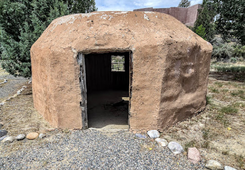
SWEAT LODGE
FEMALE NAVAJO HOGAN
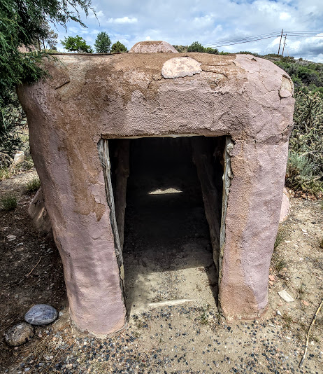
FORKED STICK HOGAN
POTTERY FIRING PIT
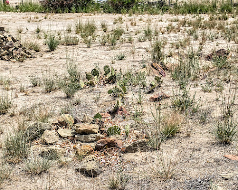
PIT HOUSE
FIRST FLOOR
STEPS TO MEETING ROOM
HEIGHT RESTRICTION AREA
STORAGE CISTS
From Heritage Park we went to the ruins via the Salmon Homestead.On the way to the homestead:
The home next to the museum/ruins had a peacock and peahen. Like most marriages, during the time he was at the ruins, she was a callin' for him.A little bit more on the Salmon family history is on your way.
If you remember, Peter came in 1877, with his family. He filed one of the earliest homestead claims in Bloomfield, which happened to be next to the ruins. The Salmon family made every effort to take care of the ruins. When their son was old enough, he filed a claim for the land the ruins sat on next to the family homestead.
HOME AND CARRIAGE HOUSE
(house was lived in until about 1960)
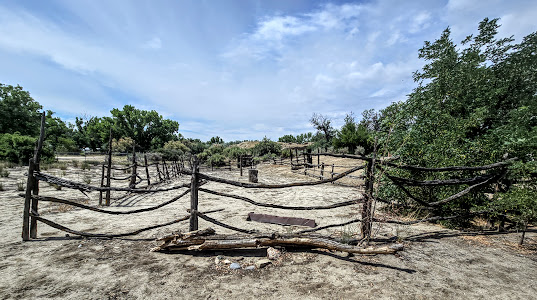
George built the house around 1898. This home was similar to the home George grew up in, but had four rooms vice three. Somewhere around 1903 Peter built a new home that was two-story. The house was built in the fashion of the region. Instead of logs being set horizontal, they were set vertical. This style was known as jacal, or "stake and plaster". Along with the house, George and family built a bunkhouse, root cellar, and a corral.
ROOT CELLAR
BUNKHOUSE
ONE OF THE ROOMS
SECOND OF THREE ROOMS
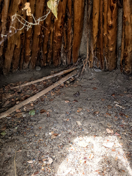
WALL CONSTRUCTION, LIKE THE HOUSE
CEILING CONSTRUCTION
CORRAL
THE ORCHARD
The Salmons harvested apples, pears, and apricots from their orchard. What you see are the few surviving trees. Thanks to a ditch constructed by Bloomfield-Porter, the trees flourished quite well in the day.
You all have been very patient to view some more ruins, so here go.OUR ROUTE THROUGH THE RUINS
There were 21 stops on the tour, some of them appear to be the same in nature, so we may pass by a couple or three in the post.
We started in the upper right corner.NORTHEAST CORNER OF THE PUEBLO
From left to right the wall stretches 394 feet, and was three-stories in some places.SIDE NOTE: the Pueblo people built their pueblos using astronomy, and this is no different here. It appears that the wall was constructed to specifically align with astronomical observations that were based on the Lunar Standstill. The wall (east) along the trail measures 164 feet, while the western wall (not shown) measures 183 feet. Refer to above map.
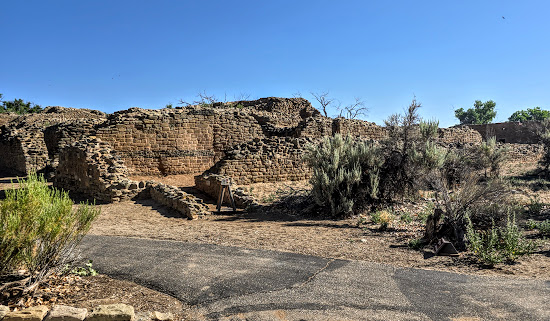
You will notice throughout the pueblo the unmistakable signs of the Chacoan Pueblo style. Both exterior and interior walls will be smooth using skillfully cut sandstone, then the center was filled with random rock and mud.
You will also see a third style of building, and noticeably different. This style of construction, called Pueblo III, was used in non-outlier areas, and consisted of round rocks with a lot of mud packed around them.
VENEER IN/OUT, RANDOM ROCK CENTER
Through research, the sandstone came from a local quarry; the wood for the roofs could have come from as far away as 25 miles.Stop #2:
NICKNAMED THE "BOWLING ALLEY"
It received that name because of the depth of the room. The design and construction were definitely Chacoan. It isn't exactly known what this room was used for when the Chacoan people were here; the remains of a small child was found here. Archeologist apparently found evidence that after the Chacoan left, the room was used for domesticated turkeys. Stop #3:
In this room archeologists found several artifacts, seeds from an extinct species of tumbleweed, and gruel made of corn flour, on part of the floor. They figure the gruel spilled when the roof collapsed. One of the artifacts, a tchamahia (pronounced chah-mah-HEE-yah) which is unique to Puebloan sites.
CLASS IN SESSION: the tchamahia was made of Brushy Basin chert that forms in bands of color, was the size and shape of a stone hoe (we're talking small hand held). These tools were commonly used to care for plots growing corn, specifically for ritual use.
CLASS OVER.
Stop #4:
This room was square and had two doors, one led to an adjoining room to the right, the second to an adjoining room that led to the plaza.
Look at the construction of the rooms and you can see the Chacoan construction that would be the smooth neatly stacked stones. In the room going to the plaza, note the round rock with a lot of mud around them. This room was remodeled after the Chacoans journeyed on; the room was made round by the new Puebloan people, and the round rock improvement.
Stop #12:
The back portion of this structure shows evidence that this was a multiple level kiva. Not many artifacts were found, but what were, are common to the rest of the occupation of this pueblo. Several hearths were found, but no food preparation artifacts.
Stop #16:
This was a second-story room, and may have had a ramada-style roof. The ramada-style roof may have been evidence of a later group of puebloan people stopping here.
Stop #17:
This was the the Tower Kiva, constructed around 1088 by the Chacoan people. It could be said that the rest of the Pueblo was built around this room, requiring much planning.
This was not a simple task. The starting point was the platform at the bottom. The platform was Chacoan veneered walls filled with river cobble between them; it was built to roughly a height of 10 feet then the walls of the rooms abut the platform to add support, as do horizontal tree trunks that were built into the fill as buttresses.
A circular foundation made with smaller cobble and adobe was added to the platform; the floor was built using layers of clay and sand. The circular foundation of smaller cobble also supported the benches.
Do not confuse the Tower Kiva with the Great Kiva, though they were made similar. Keep in mind that the Great Kiva was located in the plaza of the Pueblo.
Lets get back to construction, I will point out the differences.
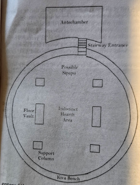
The Tower Kiva like the Great Kiva has cutout in the floor. One would most likely find a circular or square hearth that would be off center in the room, near the hearth would be a ventilation shaft. The purpose of the off center heath was to allow a ladder to come down through the smoke hole in the roof, for entrance and exit. What is missing in the photo above is the small sandstone wall between the ventilation shaft and hearth thus preventing the fire from being blown out. If you refer to stop #4, bottom photo, you will notice that the air shaft was acting more like a chimney, this was from a Puebloan group after the Chacoan Pueblo.
This next divot is hard to see, but look at the bottom photo, directly opposite of the hearth and vent.
This hole was sometimes made by burying a small ceramic vessel, and was called the Sipapu. The story of the Sipapu began with the earliest Puebloan people. It was said that this was where Puebloan ancestors climbed out to be "born" into this world (5th world).
The last two hole in the floor were vaults. It isn't truly known what the ancient Puebloan people used them for. Today's Puebloan culture have a couple of ideas, one was to begin germinating seeds for the season crops, or as giant drums for ceremonies.
Stop #21:
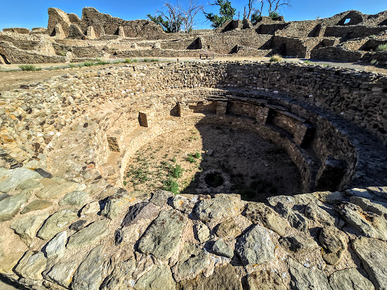
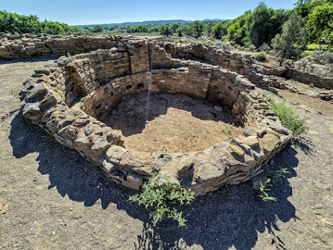
Since we were talking about the two styles of kivas, this was the Great Kiva in the plaza.
One of the differences you might notice is the entrance, it was not through the roof. The floor is similar, but because of the size of the room, it had wooden support columns.
There isn't much information as to the use of the Antechamber because there were not artifact found in the room. It is suggested that the room my have been used as a preparation room for those officiating a ceremony.
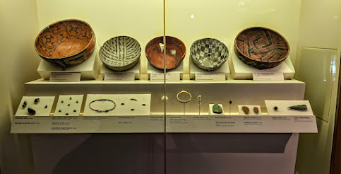
Now that we survived the ruins it was time to head back inside to the museum. The museum is a small museum that only took about a half hour to get through, reading all signs. They also had an art exhibit from a local artist.
The area in northwest New Mexico is chalked full of ruins. The next ruins were called Aztec Ruins, though they had nothing to do with the Aztecs. The name "Aztec Ruins" traces back to Spanish maps. The Archeologists are still learning if the two cultures, Aztec and Puebloan, may have had some connection within the region.
Visit: https://www.nps.gov/azru.
The first discovery of these ruins (Aztec West, left side of ruins) was by a geologist in 1859. At that time the ruins were in a fair state of preservation, with some walls reaching a height of 25 feet, and many rooms undisturbed.
Events in American history started to unfold, we called it settlers moving west. By the time an archeologist investigated the site in 1878, it was estimated that a quarter of the pueblo stones had been carried off by settlers for their structures. A few years later a teacher and students found other rooms in the pueblo, one room contained buried human remains. Soon after, many artifacts began to disappear thanks to looters. In 1889 the site became private property, and fairly safe from looters.
It wasn't until 1916 that the American Museum of Natural History sponsored an excavation of the site by Earl H. Morris. Mr. Morris spent seven years excavating and stabilizing Aztec West, the Great Kiva, and a few rooms in Aztec East. In 1930 Earl returned to reconstruct the Great Kiva.
Before Mr. Morris returned to reconstruct the Great Kiva, President Harding designated the site as a national monument in 1923, saying it was "for the enlightenment and culture of the nation". In 1987 it was declared an ONESCO World Heritage Site.
This site was maintained a bit different than the last site, so visitors are able to walk though more of the ruins.
Like many of the Pueblo communities, they were built along the life blood of the Pueblo People, a river, and in this case the Animas River.
STARTING POINT OF THE 1/2 MILE JOURNEY
A PART OF THE GREAT HOUSE
ON THE WAY TO GREAT KIVA
This pueblo took around 30 years to construct. Stones came from local quarries, and timbers from farther distances. Like other ruins, there was Chacoan influence here too.
GREAT KIVA
These ladders appeared to go up the additional rooms. Below was one of the rooms.
The Great Kiva was usually in the plaza of the pueblo community where there was access from the Great House.
It is unknown what the extra rooms were used for, but there is a theory that they were for ancestor spirits.
The massive pillars that you see support horizontal poles. The pillars rest on heavy limestone discs that came from 30 miles away. The great feat here was the installation of 95 ton ceiling, both during original installation and reconstruction.
There were two pieces of evidence found by Mr. Morris during efforts to reconstruct the Great Kiva, charred wood, indicating the roof burned, and two, red and white-washed plaster. This evidence helped him in the reconstruction.
Our next stop was another kiva, or ceremonial chamber.
Rooms like this were commonly used by clans or other groups for medicine or religious events. Rooms like this would have a cribbed roof.
Ancestral Puebloans describe the building of the roof as weaving a basket. Just like most rooms, people entered through the roof.
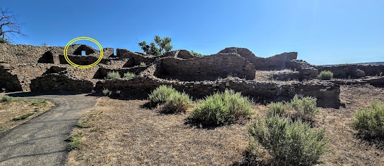
Marching along, smartly or otherwise, we visit a mystery in the building of the pueblo.
Within the circle you will notice a door in a corner. These doors were rare and unique, considering they reduce the strength of a structure. It can only mean there was an important meaning to the Puebloan People.
This section of the pueblo shows history of change. As I mentioned earlier, rooms opened to the plaza, here you can see that rooms were later added on. Some other notes are repairs to maintain integrity of the structure, replacing mortar and stones. Some of the structures are even re-buried for preservation.
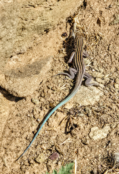
This journey through the pueblo is more than the structures:
PIGMY BLUE-TAILED AMEIVA
This kiva was at the heart of the Great House. Looking at these photos one can see evidence of Chaco Canyon influence. Notice the channel on the floor of the kiva, that was the vent for the hearth.
I haven't spoke of it before, but the next design was unique to Chacoan culture as well.
"T" SHAPED DOORWAYS
It is believed that the "T" shaped doorway may have had some type of symbolic importance. The T-shaped imagery is still used to date.
The next part of this journey was through a group of rooms, unfortunately the original doors were damaged by looters.
Those doors were not made for average height people, but did work good for warmth and cooling. Lets get marching.
A WILLOW MAT WOVEN FROM YUCCA FIBERS
These mats, as well as stones, hides, and blankets were used to close off rooms.
The southern doors led to various rooms, such as the one that had the willow mat. Other rooms included storage rooms. In the later years some of the well ventilated outer rooms were used for daily use, while the darkened inner rooms were used for storage.
We made it through the rooms which brought us to an exit.
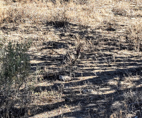
We actually walked half of the rooms. Continuing up the trail we came to:
That's right... a bunny rabbit. Onward we went.
This tri-walled structure are rare and few are found around the Southwest. It is believed that structures like this were possibly used for ritual ceremonies. This structure was partially filled in after excavation for the preservation of the structure.
Our last visitor before we moved back down the trail.
I have stated before that these pueblos were set up astronomically, and here was an example:
When looking down the north wall one can see the sun come up aligned with this wall on the day of summer solstice.
I thought our last squirrel was our last visitor... oh how wrong I was....
KING OR QUEEN OF THE RUINS
Several areas in the pueblo had a row of green stone running through them; the archeologists don't have a clue why.
From the ruins we headed into the museum... with air conditioning.
The museum was actually the home of Mr. Morris during his time excavating the ruins. Some of the timbers were borrowed from the ruins.
The gift shop/bookstore and main entrance were Earl's livingroom and kitchen.
The museum also had a short video that spoke of the site and a few photos of the reconstruction.
This was an informative journey, and would recommend it to others who visit New Mexico.
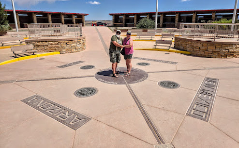
The last segment of this post was a drive by of Shiprock, and a stop at Four Corners.
On our drive past Shiprock:
A FAR GLIMPSE OF SHIPROCK
Here is a little history about Shiprock/Shiprock Peak/Ship Rock.
The Navajo originally named it Tsé Bit'a'í, which means "rock with wings", or "winged rock". The Navajo legend is of a great bird that brought them here from the north.
The rock got its present name from the resemblance of a 19th century clipper ship; it all hinges on where one is looking at it from. At one time it was accessible for climbing and photos, however, the land it sits on is now private property. There is a rumor going around in New Mexico that some rich guy is buying all these once small interest points.
We continued on to Four Corners.
To get to Four Corners we had to leave New Mexico, enter Arizona, and back into New Mexico.
My mom and I visited Four Corners when I was a youngster, many years ago. I wanted to re-visit it to see what changed.
How did this monument come about? It was first established and perpetuated by U.S. government surveyors and astronomers, beginning in 1868.
There were four surveyors, Darling, Robbins, Reeves, and Carpenter that surveyed the boundaries. Reeves surveyed the Colorado/Utah boundary to the corner (1878), Darling surveyed Colorado/New Mexico boundary to the corner (1868), Robbins surveyed New Mexico/Arizona boundary to the corner (1875), and Carpenter surveyed Arizona/Utah boundary to the corner (1901).
By 1899, U.S. surveyors, Page and Lentz found the marker in disarray, disturbed and broken; a new stone was set. The General Land Office (Kimmell) re-monumented the Page-Lentz stone with a concrete and brass monument in 1931.
In 1962, the Bureau of Land Management, and the Bureau of Indian Affairs poured a concrete paving block around the 1931 monument. This would have been the monument I first visited.
Along came 1992, the 1931 monument was deteriorating, so it was replaced with an aluminum bronze disc, built by the Bureau of Land Management.
55 years ago those structures in the background did not exist, and only the center Four Corner medallion was present. The site is now part of the Navajo Nation. We had to stand in line to take pictures on the medallion, which was our longest time spent there.
Time to head back home.
CLOSER LOOK AT "THE ROCK"
See you later.























.jpg)


.jpg)


