Time to head out for Angel Fire. The drive was a nice drive with good scenery.
All this turned into this for a while.
These open spaces didn't happen until we got through I don't how many miles of winding mountain road and a construction zone that was single lane for several miles.
Nothing like hiding out in plain sight.In looking for stuff to do, it didn't look like there was much, but we found stuff that wasn't even on our list.
Hitting a small town in the afternoon can be problematic when it comes to somewhere to eat, and Angle Fire was no different. A lot of the places here were closed after the morning service and were preparing to open for their evening service. One local suggested a bar and grill that would be open, so off we went.
CHEESE CURDS
DOUBLE BURGER W/ SAUTED MUSHROOMS
SINGLE BURGER W/ SAUTED MUSHROOMS & FRIES
SMOTHERED FRIES W/ GROUND BEEF, CHEESE, AND GREEN CHILE WHITE SAUCE
A to-go box was required. I was not expecting so many smothered fries as a side dish.The next day we decided to see if there was a different route that would not require driving the winding road again, and see if we could find the Rio Grande Gorge bridge. Off we went.
The alternate route started out ok:
That was about to change. Fortunately for us it was a weekend and the construction on this road was not happening, or we would again be driving a section of it as a single lane for three winding miles. This new route added about 40 miles to our drive into Taos. We did finally reach the Rio Grande Gorge bridge.
During our trip we passed through Mora Valley and found a little treasure that was not mentioned when Carol was researching places to see. It was in a small town, around a bend in the road, and we almost missed it.
ST. VRAIN MILL
This mill at one time was a water-powered, vertical grist mill.The mill was built by a man named Ceran St. Vrain in 1864 after his first mill burned in Taos. The mill supplied flour and meal to the nearby Fort Union. Ceran operated the mill until his death in 1870. The mill continued to operate, supplying Mora Valley residents until 1933. It wasn't until 2015 that restoration was begun.
Carol and I made it to the bridge and were a bit disappointed, we set our expectations a bit high apparently, plus that winding road wore us down. Anyway:
We didn't bother to get out of the truck and walk the bridge.It was late lunchtime, so Carol and I headed off to a place called Michael's Kitchen in Taos. Unknowingly we tapped into one of the hot spots to eat in Taos. When we got there a line was out the door, and it was close to closing time. We finally made our way into the restaurant and sat down. Carol had a BLT and I had fish and chips. The food was good and came fairly fast. Now it was time to drive back home... up the winding mountain road.
The next day we hit the visitor center in Eagle Nest, which also functioned as the Gateway Museum, nothing to get too excited about. It had an exhibit documenting the area when gold was discovered, one on fishing, and a third one I forgot. There were lots of photo books on the history of the area.
Originally the Native Americans were the only ones in the area, and that was only to hunt before winter came. Then gold was found and that changed the area quickly, bringing in miners panning for that special mineral.
The white miners started panning in the stream, then moved to Baldy Mountain. They put tons of holes in the mountain and even tried to make a tunnel, digging from both sides of the mountain. Unfortunately their efforts fell short, they never connected. In the meantime the Chinese had come in to mine as well, but the white miners told them that they could only pan for gold in the stream. Ironically the Chinese were more successful than the white miners.
One of the interesting stories was about the well-off Springer family, namely two brothers, Frank and Charles Springer. In 1916 they spent over $400,000 to build a private dam on their land.
EAGLE NEST DAM
(Courtesy of Billy Hathorn)
This dam was built on the Cimarron River for irrigation purposes then, and still today. The dam created is now Eagle Nest Lake. The dam was manually operated when irrigation water was needed, and that has not changed today. When water is needed for irrigation, the Dam Master is contacted, and he must manually open the gate.The dam itself is boulder and concrete, taking two years to complete. As time has moved along, the family some years ago realized they could not continue upkeep and sold it to the state. The dam and lake are now a state park, but the dam itself is still on private property. The village of Eagle Nest is allowed to provide tours of the dam monthly.
After the museum/visitor center we drove over Cimarron Pass in search of little treasures. One of the treasures the information lady offered us was the remnants of the Eagle Nest Lodge.
EAGLE NEST LODGE (ca 2008)
(Courtesy of Kathy Alexander)
Visit for a bit more information:
https://www.legendsofamerica.com/nm-eaglenestlodge.
Apparently two fires did the damage, and it was suspected that vagrants caused the second fire. I really do encourage you to visit the website.
The state has graciously provided historical markers along the drive through the Cimarron Pass.
OPPORTUNITIES TO STOP AT ON THE DRIVE
We did some of the points of interest (POI). Part of the drive was through the Cimarron Canyon State Park, which has many campgrounds for people who enjoy tent camping, and RVers that enjoy dry camping (provide your own amenities). Some had bathrooms. The park is great for backpacking, fishing (trout), camping, and viewing wildlife.
Historic Marker: Palisades Sill
The igneous rock (crenellated granite, also known as sill) was cut by the Cimarron River flowing at the foot of the mountains. This area of the Southern Rocky Mountains is estimated to be 40,000,000 years old. The elevation at this point was 8,000 feet.
DEVIL'S MAILBOX
As we drove I noticed signs along the road that said "Red Chile Water"?
The signs pertained to how trout could be caught.
We drove a little further, then decided to turn around and head for lunch.
EAGLE NEST LAKE
(94,000 acre ft of water)
Back in town we stopped at the Laguna Vista Saloon for lunch/dinner. The food was good, but I need to remember fried food is no longer my friend.
CHICKEN FRIED STEAK
W/ LOADED MASHED POTATOES
CHICKEN TENDERS W/ MAC AND CHEESE
All the food was freshly made. The mushrooms were fresh, dipped and fried; you could tell they were not frozen. Carol and I thought they used the same batter on all the dishes.
It proved to be a small world. While we were enjoying our meals, Carol was having a beer and I a hard cider, when a gentleman walked in and sat next to Carol. They struck up a conversation, keeping the story a little shorter, he raised cain with Eric when we lived in Chula Vista, CA, back in the 1990s.
After lunch and conversation Carol and I headed to the fudge shop next door, then home.
On the way home we stopped at another treasure not on our list, the Vietnam Veterans Memorial.
The memorial was the first one ever for Vietnam Vets. It was started when one of Dr. Westphall's (founder of the memorial) sons was killed in action in Vietnam. Originally it was only the chapel:
The story began in Vietnam on 22 May 1968. Eleven Marines died that day, including his son, when they were ambushed by North Vietnamese Regular Army. Two other Marines died the following couple of days from their injuries sustained during that ambush.
Thirteen is the number to remember. Victor Westphall had determined that thirteen photos of the fallen Marines would hang in the chapel, the cross would be thirteen feet tall, the flag would have thirteen stars. Coincidently Mr. Westfall was born 13 Oct 1913.
The chapel opened in 1971 to the public. Today the chapel is open 24/7; they use to lock it at nights. What changed their minds about leaving it unlocked? A person visited the chapel one day when it was open, that person came back another day and found the doors locked. This person left a note for Dr. Westphall that read, paraphrased, when I needed the chapel the most, the doors were locked. From that day forward the doors have never been locked.
As Dr. Westphall grew older, the family realized they could no longer maintain the memorial, so they tried to find an organization that would take over, that organization became Veteran Affairs.
I understand these words. In the early days of my career, service members were not suppose to tell the family where they were deploying to, or what their job was in some cases.
Once Veteran Affairs took over, the museum was added, and opened to the public in 1980.
Dr. Westphall was a Navy officer that served in WWII. One son served in the Marines, the other in the Air Force. The Westphall family is a proud military family, as his grandson served in the Army. For this cycle to be complete, the great grandson needs to serve in the Coast Guard. All service would be covered.
Like many service members, I am PROUD OF MY SERVICE AND THIS COUNTRY. Like all people and nations, we are not perfect.
This drawing (a reprint on exhibit) was done by the acclaimed war artist George L. Skypeck in 1983. It commemorates the service and sacrifice of combat-infantrymen during Vietnam.In 1984 Russ Vaughn and the artist became friends and the artist personalized a copy of the print for him. Russ's first copy of the print faded after 25 years on display, so Mr. Vaughn found another copy and added the personalized portion from the first print.
Copies of this work have hung in the White House, Capitol Building, the Pentagon, and the Veterans Administration. People like Bob Hope, Colin Powell, and Gary Burghoff (M.A.S.H. fame), Tom Selleck, and Senator John McCain have displayed the work in their homes.
The first attempt of soldier identification was during the Civil War, and at that time they were called "name discs" or "soldier pins". By 1906 they were created using aluminum. 1913 saw All service members wearing these discs. During WWII service members were issued rectangular tags, and are still being issued today. The WWII tag had a notch at the bottom, that was when they became known as "dog tags". It is not certain, but the term "dog tag" may be traceable back to Thomas Jefferson. In the 1950s two tags were issued, one on a long chain, one on a short chain. The one on the short chain later became known as the "toe tag". These tags contain important information about the service member.
This breastplate was made from bone beads, hair, and 30-06 Winchester shells used in the M60.
BEADS, HAIR, AND 30-06 SHELL CASINGS
Breastplates was made to protect the spirits and to heal the memories of those who served in Vietnam and during the Vietnam era. Notice the green, yellow, and red beads, they represent service in Vietnam. The placement of the beads in the hollow of the shell represents honor for all the brothers and sisters that gave their lives in Vietnam, for their country. The center is traditional hairpipe (white) with red and blue beads, representing the United States. The entire breastplate is darkened to to represent how our country was and is tarnished because of the war, and remind us that it is not finished until everyone is home.
HUGHES OHU-6 CAYUSE (KILLER EGG)
This helicopter was lightweight and fast, used for observation. The helicopter was used in tandem with the Apache helicopter during "bait and switch" operations. The killer egg would fly low above the trees to attract enemy fire, then the Apaches would come in and destroy the enemy site.
Items surrendered, captured, or recovered by allied forces:
I can't imagine thinking about dodging stuff like this every day:
I'm paranoid dodging items flying out from under the lawn mower.
How many of you out there remember these:
I wore one in high school.
Heroes sometimes forgotten come in all forms, some of those were our service members that were held as prisoners.
The photos you see here were taken by a gentleman that served in the Army unit that served as linguists for prison releases. The photos were taken with a borrowed camera. The only authorized free-world country press and photography team allowed were from Canada.
Notice in the bottom photo, the service member on the right was to become a senator for Arizona, his name, John McCain.
Once released the freed prisoners boarded a C-141 for Clark AFB in the Philippines. After medical checks and debriefing, they flew home to U.S. soil. There were 83 photos taken during the releases and three full sets were developed. One copy went to the State Department, one to the CIA, and a set for briefings with the linguists. The only photos Mr. Sawyer kept are on display at the memorial.
We cannot forget our four-legged friends that served with honor.
One of their most important roles in the jungle was searching out the enemy in caves.
We could have spent a bunch more time in this museum. We wished we had stopped here instead of driving to the Rio Grande Gorge bridge.
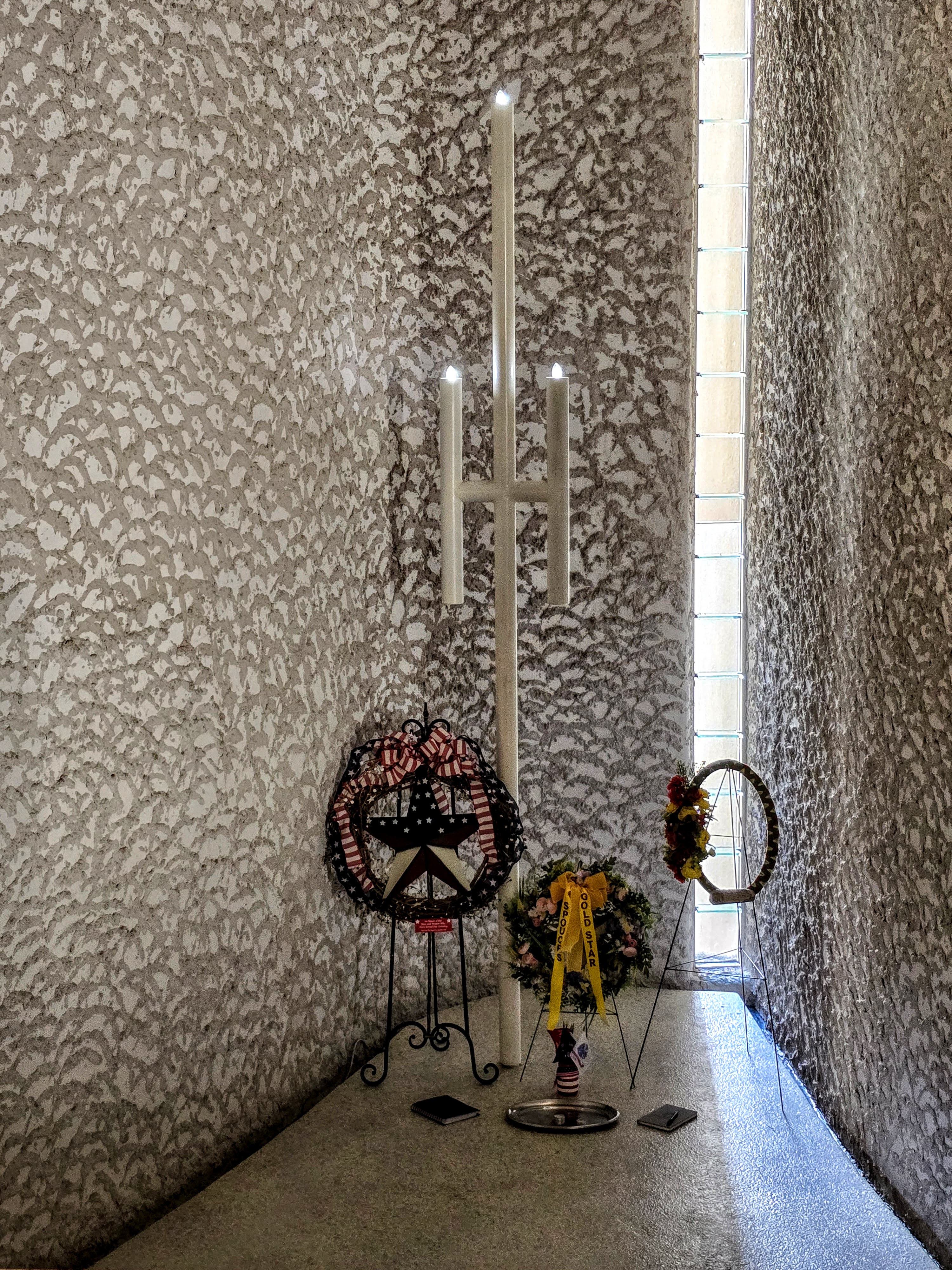
This is the resting place for Mr. and Mrs. Westphall. If you are wondering why there are two headstones on one side, one is the headstone provided by the Veterans Administration, the other was because Dr. Westphall wanted a matching headstone with his wife's.
Now we have been through the museum, lets talk some about the museum itself and its first curator.
The museum was constructed such that it would not interfere with the views of the surrounding area, so it is virtually underground, with only about two feet of top soil covering it.
The memorial, and later the museum were Dr. Westphall's life. In fact, when the museum was built, an apartment was added to it. As time went on the Veterans Administration thought it was time for the doctor to retire, he would have none of that.
Continuing across the street visitors can see a replica of the wall in Washington DC.
It was interesting to learn that Dr. Westphall became good friends with designer of the wall, and had the final design vote.
The state has a veterans cemetery below the memorial. The last photo was taken from the cemetery, and to the left of the chapel is the museum. The other two photos are looking from the wall. Those flags flying were for the "Run for the Wall" motorcycle rally. Those flags were up and down stretches of highway here.
Now we can go home.
The next day we drove with the intention of seeing some ghost towns... what a bust.
We headed back up the road through Cimarron Canyon State Park. Our first stop was in the village of Cimarron. The village was located on the Mountain Branch of the Santa Fe Trail, established around 1844. In 1857 it became home to Lucien B. Maxwell and the famous 2,000,000 acre land grant. An agency for Utes and Jicarilla Apaches was located here from 1862 t0 1876. Cimarron valley is the separation between the mountains and the high plains.
While driving to the ghost town that doesn't exist, we passed the Boy Scout property, and there was a lot of land owned by the Boy Scouts.
Our goal was to find the Colfax Ghost Town. We drove down a bumpy, rutted dirt road for over five miles, and all we found was a house that could be toured. Later we learned that the ghost town no longer existed because it was on private land. The owners burned the wood structures, so the only structures standing are a few adobe walls.
We headed back down the hill to the next ghost town in Elizabethtown. Hidden treasure alert, we found another spot to tour in the form of the Aztec Mill.
Visit: https://www.aztecmillmuseum.com.
The mill was built in 1864, and today it is an eclectic museum.
As one drives through New Mexico, especially in the northwest, signs along the roads will indicate which land grant one is on. These land grants were given to prominent people by Spain, and when Spain was defeated by Mexico, the Spanish grants remained in effect, and Mexico permitted more.
Charles Beaubien was a French-Canadian who married into a influential family, became prominent in public affairs, and eventual became a judge. He and his partners petitioned the Mexican government for a large piece of land along the eastern flank of the Sangre de Cristo Mountains. They received one of the biggest land grants, approximately 96,000 acres to Charles Beaubien.
Now came the rub, Mexican-American War. The native Mexicans and Indians were concerned about granting land to non-natives. This led to the Taos Revolt of 1847. During the conflict, his only son was killed.
With order restored, Beaubien asked his son-in-law Lucien Maxwell to manage the grant. Lucien and a friend (Kit Carson) moved over the mountain and built homes on the land. Both Lucien's territorial style home, and Carson's rebuilt hacienda can be seen near the waters of the Rayado River.
Now, lets talk about Lucien Maxwell. He was born in Illinois, but most of his early life he was around trading posts of the Colorado frontier, where he met his life long friend, Kit Carson. He and Carson explored the west several times with John Frémont.
While in Taos, he met Luz Beaubien, Charles' daughter, and married her in 1844. 1847 is when he took over managing his father-in-laws grant. To give you an idea how wise this man was, he took that land grant and built up to over 1.7 million + acres by 1868.
The following year, around 1848, he and Carson began constructing permanent structures near the Rayado River, which is about 11 miles south of Cimarron, NM. He stayed there only 10 years before he moved his headquarters further north, along the Cimarron River. This was achieved before 1868.
Maxwell had government contracts for grain, cattle, and the selling of supplies, and leased land to settlers and miners. This made him a wealthy man.
Lets chat about 1868 now. He approached Beaubien's partners and heirs and purchased the land grant, which made him the wealthiest landowner in the U.S.
By 1870 Lucien was ready to sell. He sold the grant to a groups of investors for $1.35 M. With that money he moved to a familiar place previously covered, Ft. Sumner. If you remember, he bought that place off the government for $500.
One can find him peacefully resting in the Ft. Sumner cemetery.
What happened to Charles Beaubien, his wife Pabla, and their granddaughter Verenisa (age 4). Pabla and Verenisa are buried northwest of Old Town Cimarron, Charles is in Taos under a parking lot of the the church of Our Lady of Guadalupe. We passed that little church on the way to the Rio Grande Gorge bridge.
On to the eclectic items in the museum. The exhibits in the museum are mostly donations from the residents around the area.
This tea set belonged to the wife in the Springer family, an influential family in the area... you know, the ones that built the private dam.
COYOTE SKULL WITH AN ARROWHEAD IN IT.
COMPETITION W/ PROCTOR & GAMBLE
CARVED IVORY (REAL)
(made in China)
BOY SCOUT TROOP BADGES
COLOR WHEELS FOR INDIAN DYES
HAND DRILL
FRUIT JUICER
I haven't mentioned the mill itself. The mill was constructed in 1864 as part of a treaty with the Indigenous people of the area. The mill is a four-story structure.
TYPICAL MILL DESIGN
The one difference between a typical design and the Aztec Mill is where the water wheel is located; Aztec Mill wheel is located inside the mill.
MILL STONES CONNECTED TO DOWNSTAIRS
TURNS THE MILL STONES ABOVE
After touring the mill, we headed to find another ghost town, Elizabethtown. We found our goal... NOT! We did learn that Elizabethtown was the first incorporated town in the area because of gold found in the region.
We licked our wounds and found the brewery, Cherokee Creek Brewery.
THREE BARREL VATS
CAROL'S CHOICES
While enjoying a cold one divided by four, and a sparkling water, we learned that there wasn't much to see in Elizabethtown now days.
We arrived to the brewery before the rain:
After the short pitstop we headed home.
Our neighbors came out while the weather was so-so.
Who says they all look alike... the top guy is looking right, the bottom guy is looking left. In all seriousness, there were prairie dogs everywhere.
Our last day looked like this:
MOUNTAIN STORM NEAR US
OUR SHARE OF RAIN
Our last Day
Our next stop will be in Farmington, NM.


No comments:
Post a Comment