The drive from Green River Utah to Monument Valley Utah was very enjoyable. There were many sights to see while steaming down Hwy 191. We made a quick stop alongside the road for a photo opportunity with a random arch by the name Wilson.
Apparently this arch was named after Joe Wilson, a local pioneer that had a cabin near the arch. There was a trucker taking all kinds of pictures, so I walked over to him and asked him if he would like a photo with the arch, he gladly accepted the offer.We raised anchor and sailed on down the road again. We passed the exit for the southern half of the Canyonlands National Park, now we know how to get to "The Needles".
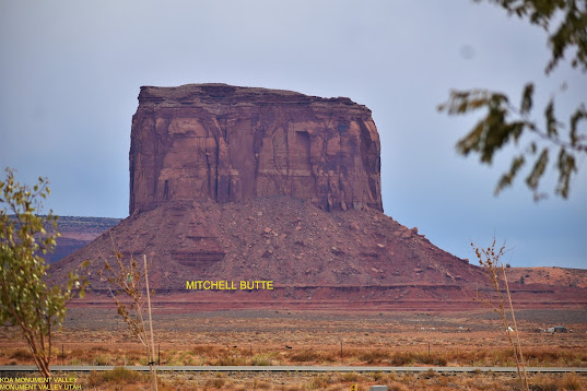
We arrived at our new digs for the week... what spectacular views, every direction had something to enjoy.
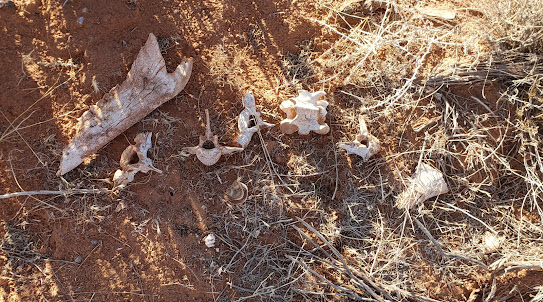
I'll take a chance at losing internet for these views. The campground isn't far from the Navajo Monument Tribal Park entrance either, but their park is a no-go due COVIDS, it's closed until further notice. The draw back to their being closed is missing out on all the stories to be told.When we arrived we were told it is only two miles and turn right to get to the grocery store. Wellll... one day I decided to go for a hike to the Goulding grocery store... fairly simple hike, two miles up and two miles back. I was wrong in that assumption. It was two miles to the turn, that was correct, the missing part of the equation was the additional one mile after the turn. I did not decide to go the extra mile. My decision was based on the fact that having walked the first two miles of what could have been construed as sandy dunes, part of which required emptying from my shoes... I had to return back to the campground over those same dunes. The other factor of my decision was the fact that I'm retired and I don't have to do it if I don't want to... and I didn't want to. However, on the way back I did run across someone/something that didn't make it.It had been gone a long time before I got there.
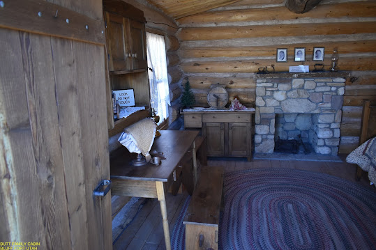
When I returned home Carol and I took a drive up to Bluff Utah, home of Bluff Fort. Bluff Fort was a Mormon missionary settlement, its purpose to evangelize the Indians. Most of the cabins are recreations of the original ones a century ago. Each of the buildings was hooked up to pushbuttons that told little stories of the folks that lived in the cabins and what the buildings were used for. The cabins were all similar, one room with a sod roof.
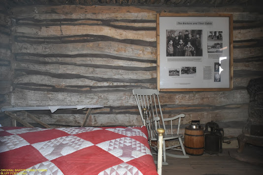
They had a blacksmith shop to take care of their metal needs, whether it was shoeing or farm implement repair.They did manage to save part of the Barton's original cabin. Their allotted parcel of land was the fort site and as families moved to their permanent homes, their cabins were moved and added to the Barton home, which eventually became a five room house.

Walls were cottonwood trees harvested from down by the river.
A breezeway was created when one of the cabins was added.
The kitchen was the back room in this photo.
Initially pot bellied stoves were the common form of heating in the cabins, eventually they built fireplaces. Being a social community they also had a place for gatherings, the Log Meetinghouse. Like the other buildings, the current building is a recreation of the original one.
All the cabins and buildings acted as the outer perimeter of the fort, doors and windows faced to the center of the fort. I have only provided a little history of this community, for more information go to: hirf.org/fort.html.
Walking through the site built of an appetite, and we were directed to eat at the Twin Rocks Café since they were probably the only one serving lunch. It got its name from the formation above it:The café was more in the line of a sub shop: bread, protein, other, and condiments. The menu was a fusion between Native American Indian and Mexican.
Carol ordered corn tortilla street tacos with carne asada, corn salad, sour cream, and cheese; she opted out on the beans and rice. I had pork carnitas on Navajo Fry Bread, lettuce, corn salad, guacamole, and sour cream. The food was very tasty. Carol was a bit surprised by the flavor of the carne asada, expecting to be seasoned the Mexican way... nope, they used different seasonings.
With lunch checked off we took a drive through "The Valley of the Gods". We were on a recon mission to find suitable sites for boondocking (dry camping). The distance we drove through the valley, unlocked several sites that would work for our trailer. The reason I say there were several sites is because we did not drive the entire 17 mile road to look for more. The roads getting to the ones we found were a bit rough, but manageable. Bureau of Land Management (BLM) roads are not allows the smoothest to travel, but in many cases worth the travel. Valley of the Gods is a prime example of traveling those less than perfect roads for a view.These are only a small sample of what there is out there to see. Most of the sites we found had a view of one or more of these formations.
Coming back to earth we sauntered up the road to Goulding, a community owned by either a single person or a corporation, not sure. This little community had a grocery store, gas station, car wash, laundromat, fancy lodge, rental houses, RV campground, restaurant, post office... and a gift shop.
After Carol bought a birthday card and a few sundries we headed back down the road and turned right instead of going home. That right turn took us into Arizona. By looking on the map we knew that the K.O.A. we were staying at was near the border, what we didn't know was that near meant less than 10 miles. So we drove a short distance into Arizona and turned around to head home.
At the roundabout heading home, if we turned right we could drive four miles up to the closed gate of the Navajo Monument Tribal Park (NMTP). Now, about three miles before the roundabout we crossed back into Utah. Drive about a mile up the road to NMTP one is back in Arizona. Apparently a good portion of the park is in Arizona, with a piece in Utah.
The next day we planned a trip to see "Mexican Hat" rock which was halfway between home and Bluff. As we were toolin' down the road, our turn off jumped out at us, one of those fine gravel roads with ruts and potholes. We of course did not let that deter us from a photo opportunity.Here we are looking at Mexican Hat from two sides. I figure they chose "Mexican Hat" because it looks like an upside down sombrero.
Following Garmin isn't always the right thing to do... it presented a picture that we could drive around the rock formation... WRONG. We had to drive back down the road to an intersection that took us on another road behind the rock. The second photo above is from said road.
If we were looking for new places to boondock, this road would not be a choice decision for traveling to a site. If I mentioned rough roads before, they were very nice roads compared to this one. With that said, people have camped off this road. The neat part about this road was the end.
Both photos are at the waters edge.
The river running by was the San Juan River. I couldn't tell if it was good for fishing, but the sound of a quick flowing river was very peaceful. Here are a couple more photos from that back road:The gorge was just beautiful with all its different layers of color. Traveling these types of roads makes Carol and I glad we bought a truck with four wheel drive.
With a little imagination one can see just about anything in these rock formations. As I was driving past a small formation on my side of the truck, it made me think of a diorama of an ancient Indian cliff village.There are lots of holes in the rocks giving the impression of cave dwellings.
Once we got back on the highway we took the opportunity to stop at the many scenic turnouts. All these photos are from scenic turnouts on Highway 163. What is fascinating about this area is that you can pass by these formations different times of the day and they would look totally different because of the way the sun hits them throughout the day.
We made a pit stop for gas and lunch at Goulding's. Headed back home and consumed our chicken tenders; Carol did laundry, and I downloaded and edited photos.
One of my many mornings from my recliner and out my window, what do I see...A glorious sunrise.
Can't get any better than that, unless it is out boondocking without obstructions.
Off on another adventure again. We took a drive down a road that started out good, it was paved, but that didn't last too long. Our goal was to go see a rock formation entitled "The Train", it looked like a navy ship that chauffeured Marines to their "happy place", oh well. We got back on that nice paved road... only for it to betray us, it became gravel/dirt again. This part of the road was probably one of the worst we have been on in our "off road" experience. We hit sections that were sand traps to the golfer, in this neck of the desert they were a connection from point "A" to point "B". After the traveler traverses the sand traps, it's back to the washboard road for only six more long miles. We made it through to the end and arrived at Goulding... what a ride. We continued across the highway and drove up to the Navajo Monument Tribal Park to see if they had any flyers available at the closed gates, and we were not surprised that nothing was available. Our days journey came to an end as we parked alongside our trailer.
It was a good thing we didn't plan anything for the weekend. Friday night a southeast wind began to ravage the land, blowing red sand everywhere at speeds up to 35 mph. Morning came and it continued into early morning hours Sunday. Most of Saturday the winds stayed constant around 35 mph, with gusts at 50+ mph. Some of the gusts had the trailer rocking so much you would have thought we were having a major dance party. With the door, windows, and vents closed sand was still being pushed into the trailer, especially around the front door.
That was Saturday afternoon, and lasted until early hours of Sunday. Needless to say our traveling had been curtailed.
Next stop will be Winslow Arizona. I am publishing this while I still have internet.


No comments:
Post a Comment