There's going to be a small geography lesson... no test.
It was a long drive from Helper Utah to Green River Utah... it took us almost an hour and a half to get to Green River. The truth of the matter is that it was only 71 miles between the two towns.
GEOGRAPHY LESSON:
The Green River meanders through Wyoming, Utah, and Colorado. Originally the river was called Spanish River, however, in 1824 it was renamed Green River. The name was changed because sections of the river are green due to the green soapstone banks. No, the river is not green the entire length. The river travels 730 miles before dumping into the Colorado River.
The river has many tributaries that feed it. The chief tributaries are the Yampa in Colorado, the Duchesne, Price, White, and San Rafael in Utah.
Flowing out of Wyoming it is dammed at several locations, below La Barge forming the Fontenelle Reservoir, and below Green River (WY) flowing through Flaming Gorge National Recreation Area. Here it is dammed up creating a reservoir before continuing on through Utah. Flowing through Utah it makes a turn east into northwestern Colorado's Dinosaur National Monument, then returns back to Utah. The river continues southwest past Green River (UT), and turns southeast to join the Colorado River below Moab in Canyonlands National Park.
GEOGRAPHY LESSON COMPLETE.
Our new homestead is in Green River Utah at an older campground called Shady Acres, kind sounds like a rest home doesn't it. There are three RV parks in Green River, a town of approximately 925 residents, and could swell to almost double if the RV parks are filled at the same time.
The town is so small that the Shady Acres laundry, gas station/mini mart, car/RV wash are shared with the town residents. There are as many as three or four places to dine, and allow eat in dining, although mask are required to enter the establishments. For fast food you can go Blimpies, Subway, or Arbys... Subway and Arbys are located at the Love's fuel stop, the big gas station in town.
Colder weather appears to heading our way, the office clerk told us at check-in that water would be turned off in the park sometime this weekend. We came back from one of our excursions to Arches National Park and found a note on our door informing us that water would be turned off the upcoming Monday. The folks were accommodating by offering us the opportunity to move to the front area of the park where the water will not be turned off, providing we had a heated water hose... we did. We are now in a new site.
Let's get to what you all have waited for, our wanderings of the land. After our usual settle in time we headed out to Arches National Park. Carol and I are so glad we have the Seniors for Life Pass for national parks, 'cause they average $30.00 for a 7 day pass for each park, our pass lets us in free anytime. Anyway, I digressed...again.
This is the starting point after the main gate adventure. I say that because the lines at the main gate can go out 1/4 mile to the highway. The exhibit portion of the Visitor Center was closed at the time of our visit, but our money was good at the gift shop.Once the traveler gets past the Visitor Center, their vehicles magically begins making its way up the hill toward the valley.
This is the first overlook, it allows for an opportunity to view the fault line up close. It is my understanding that when the right side of the fault dropped 2600 feet about six million years ago, the freeway was not there yet.Driving past this point I can only show photos of the magnificent rock sculptures:
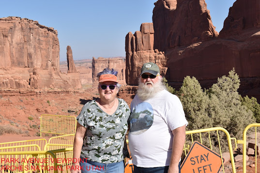
This was our second stop, called Park Avenue.
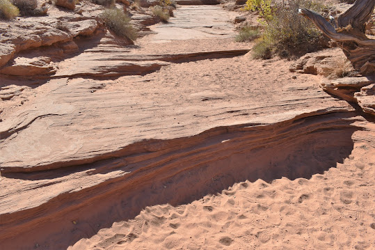
I hiked this trail for about a mile to Courthouse viewpoint. The trail is an old river bed.
This ridge is called "Courthouse Towers". I took this photo before I descended down to the river bed. Once in the river bed, it was marvelous. The walls extended over a hundred feet above the trail, majestic as ever, and I'm sure they had stories to tell. I had a great time walking on this trail, there was a life story being told of the river that flowed through it however many years ago.The trail followed the flow of the river, with its white water areas, calm pools, and mini waterfalls. The photo above is looking upstream.
There was so much to see all through the hike.A piece of petrified wood, or a rock?
half way through the hike there was a rock formation called "The Organ".I thought the bottom middle was cool... kind of like someone sitting with their back to the audience, playing the organ. Then there is a tower formation on the opposite side of the trail.There are starting of arches throughout the park. Here is one during the "Park Avenue" hike.
Coming out on the "Courthouse Towers" viewpoint there is a spectacular formation called "Tower of Babel".
As you can see, all these sandstone formations are beautiful. Once I met up with Carol at the viewpoint we headed out to the next turn out. The fall did not miss the canyon:The beautiful rock formations continued as we headed to the "Balanced Rock".
We're getting there, in fact, you can see the balanced rock in the lower photo. The balanced rock is a work of art at any angle.
Looks like someone took a glob of putty and stuck the two rocks together,
While Carol and I were hiking around "Balanced Rock" I looked over at a rock formation next to it, and to our surprise what do we see:It, I mean he, might be hard to see, there is a climber at the top of the rock formation. Apparently there are quite a few rock formations that are climbable.
It was surprising how busy the park was for the middle of the week. As we were leaving "Balanced Rock", there was someone ready to swoop into our parking space.
Let's continue to "Garden of Eden" lookout. From this viewpoint one can see into the valley on one side, and more rock formations on the other side. One of the rules in the park is "it is ok to climb on hard rock, and stay on marked paths". At "Garden of Eden" lookout take that rule seriously:This is one of the pinnacle rock formations that is climbed quite frequently. It towers about 125 feet above the base formations. The short time we were there people were lining up to climb the formation. I was happy to just climb up the base formation, a large rock about 15 feet high and mostly flat.
Looking out over "Salt Valley" to "Fiery Furnace".
Our next stop was at the area was the Windows Section. This area is famous for some of its more spectacular arches, that's right, I finally said arches. This area is extremely busy, and parking was hard to find. The section is broken into two parts (1) "North" and "South" Windows, (2) "Double Arch".
With parking so hard to find we parked on the "Double Arch" side. The walk was a short 1/4 mile to the arch, and what a view.
This arch was formed by water flowing through the sandstone in three places, there by forming the two arches.
I am actually standing under one of the arches.
Here is a small arch being formed, in a few thousand years it too may be as spectacular as its brothers and sisters,It was visible from the path up to "Double Arches".
We tried to get to the other side of the parking lot without success, so we did not get to the "North" or "South" Windows. I was able to get a shot from the car though. We were hoping to make the next day but we were slower than the average tourist. This a photo of "North Window", and as you might be able to see. there are a lot of people on the trail.
The Arches National Park was spread out, so Carol and I decided to return the following day to finish our tour.
Day 2 of Arches National Park. We were going to drive up the northern section of road to more arches and formations. But before we headed that way we tried to see the "North" and "South " Window arches, without success. It wasn't a total loss though, we did get a photo of the formation "Elephants on Parade".The elephants are clumped together. Don't tickle me, I didn't name these formations.
Well... we finally headed for the northern portion of the park. We passed through "Salt Valley" on our way to "Fiery Furnace". Oh wait, I'm lying. We made a run over to "Delicate Arch" first since it was on the way. We made a mistake coming back during a weekend day, it was quite busy, and parking was terrible at best. From the parking lot it is approximately a mile hike to the "Delicate Arch". The other option is to drive to the "Delicate Arch" lookout point and take pictures... we did.
People who hiked out to the arch stood in line to take pictures under the arch, I figured it was good to get a photo opportunity at a distance. The opening of the arch is 45 feet high, and 33 feet wide. If we're good we will move on through the valley to the "Fiery Furnace"

As I have stated before the rock formations here are just phenomenal, however some of the formations just have an attitude:This guy doesn't seem to like visitors, but he appears to be the only one that doesn't like us. Onward we go.
Arches National Park has approximately 2,000 arches throughout the park, and we are about to see three of the eight in "Devil's Garden". The first two were pretty easy hikes to get to, they were "Pine Tree" and "Tunnel".You don't think I'm going to show the arches without first making you work for it, do you? This is the trailhead to eight arches in this area. A little farther up the road we came across a rock that was two-faced:Buffalo
or
Gorilla
You decide.
We had a decision to make...We chose to hike off to "Pine Tree" first, it was the farther of these two.
We grabbed our photos here, and started back to the "Tunnel".The "Tunnel" actually has two arches... the one on the right is "Tunnel".It is just amazing what time and weather can do.This was the little guy with no name.
We took a break before we headed for the third arch we were going to visit, called "Landscape". This hike was a bit longer and more strenuous. On the way, there were some interesting rock formations, which I chose to give my own names to.
For submariners these would be the sail portion of two submarines nested (tied) together.
For you dinosaur lovers:The backbone and tail of a dinosaur or alligator. Marching on smartly, or otherwise, we got close to "Landscape" arch.To really get a good picture of this arch required a steep climb to get under the arch... I settled for a long distance photo. From here Carol and I hiked back to the trailhead, about a mile and a half. Our total hike to these three arches was close to two miles.
To hike all the the trails would have been about seven miles, some of which would have been strenuous level trails involving climbing over boulders. Having finished the trails we could have seen "Navajo", "Partition", "Double O", "Dark Angel", and "Private" arches.
For the adventurous there are unimproved roads to even more arches. The roads are accessible during good weather... we didn't try it this trip.
It was now time for us to head home for awhile.
Carol talked with her cousins and learned they would be near us and were planning to stop by. There seems to be a purpose for everything, because when they came by, the weather was going to drastically colder in the upcoming days. The day they arrived was a nice day, so we all went to lunch, then back to our trailer. Carol's cousins have a dog, so when we got back to the trailer they took their dog for a walk, and decided they liked the campground. Knowing the weather was going to take a dive in temperature they made reservations for a few nights at our campground. They were staying in the desert, which did not offer protection from the wind and cold temperatures.
The day after Carol's cousins settled in, we went to the John Wesley Powell River Museum (johnwesleypowell.com); this sight is not a sure site. The museum documented Powell's efforts to navigate and map the Green and Colorado rivers. There is a short video telling his tale as he and his crew journeyed down the two rivers. It is a small museum and can be walked in a couple of hours.
After the museum we all took a drive out to a place called Seco Valley, where there were petroglyphs. You will see in some of the photos everyone is bundled up, that's because the weather was clear and a crisp 33 degrees with a wind blowing from the north, making it feel like the mid 20s.
Most of the area was private property, but the owners were willing to share with others, providing folks respected their property.
It can been seen that not only did the Native Americans tell their tales on rock, but pioneers as well. Mr. Whipple's full name was Nelson Gay Whipple. He was born in 1858 and died in 1944, born and died in Utah.
Earlier wall art:
We drove farther up the road to what was left of someones home in Thompson Valley.
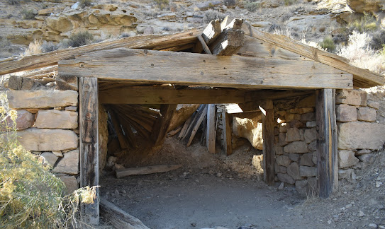
This building looked like it might have been a shed. That beam running from back to front of the building is on large tree. The window on the left utilized what looked like a piece of railroad rail at the top of the frame.
Our next building looked like it might have been a cabin.
It looked like someone made an effort to preserve the cooking oven.
We turned the truck around and headed back to Seco Valley to see what was left of a mining town and a cemetery. The cemetery was really small, and the last person buried there was in 2017.2017
1926
1918
Let's continue our drive to the ghost town. The first place we came to was the shell of the town store. The store was a two story building, main floor and basement. Like the cabin and shed in Thompsons Valley, railroad rails were used as part of the window and door structures.
This a appeared to be the back of the building, probably where supplies were brought in.The floor joists looked like they had been cut out for use somewhere else, or firewood.Railroad rails used for window frame, and over door.
Appeared to be the front of the store. Out of the photo were steps leading to the door. Behind the store was another building that may have been a store house.
The residents lived downstream of the store. One of the homes appeared to have some bad luck... a boulder came tumbling down on the house, not sure if it was when someone was living there.

This could have been an opening to a mine shaft, long caved in.
There was a train that ran through the area as well, probably servicing the mines, and possibly the store. The only remnants of the train were broken down trestle that ran across a small stream, and a stretch running by the homes.It proved to be extremely cold so we all climbed back into the truck and headed back home for happy hour.
That cold afternoon was to lead into a very cold night, the temperature dipped into the teens, with a real feel temperature in the single digits. That heated water hose I mentioned earlier, worked like a champ.
The next day was fairly quiet, Carol's cousins were leaving the following day and were making their preps for departure, we did not forget happy hour though. Again we had another really cold night.
A couple of days later Carol and I took a drive out to "Crystal Geyser".This geyser is the result of someone drilled an oil exploratory well in 1936. The pipe in the middle is there because in the early days someone fell in the abandoned well.
This geyser is interesting. Unlike hot water geysers, this one is cold water. This geyser erupts due to a trapped reservoir of CO2, and erupts at fairly predictable intervals, just not while we were there. This is what it looks like when it cooperates:When it isn't "geyser-ing", people can roam around the flows.
The geyser flows to the Colorado River. It was so cool seeing all the colors caused by the minerals being spit out. For more information go to: geology.utah.gov.
The following day we drove to Moab Giants Museum. The museum is an outdoor walk the the different time periods when dinosaurs roamed the earth, a 3-D paleo-aquarium, indoor museum, and a theatre. The theatre had a 10 minute presentation, but Carol and I did not go in. The indoor museum was small, the outdoor walk was nice. With that said, Carol and I were a bit disappointed over all. For the price I expecting to see real dinosaur artifacts, didn't happen. If you are curious, go to: moabgiants.com.
After we walked through the museum we headed over to Green River State Park for a drive through. The state park might be a nice place to spend a couple of weeks. Driving towards the state park didn't look like much. Some state parks will charge travelers who are just curious about their park, even if it is just a drive through, so we decided to go to Canyonlands National Park for a quick visit. Talking with some folks we met in the park, they said Green River State Park is a nice place to visit.
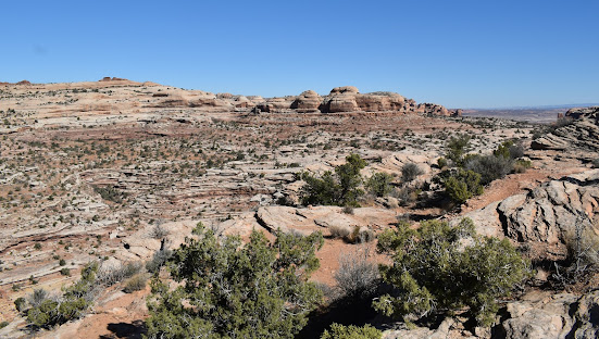
Between the turn for the state park and the national park there are formations to see, and biking and hiking trails to explore.This photo is from the first lookout point we stopped at. You will notice at the bottom right is a road, it is THE road we took to get to the lookout. The views were fantastic from the lookout. The day was clear so we could see for miles.This was just a part of the views from the lookout, the real reason for stopping at the lookout point was to view rock formations entitled "Monitor" and "Merrimac"... the very vessels that fought each other during the Civil War.The foes are sizing the opponent just before battle, Merrimac (Confederate) on the left, Monitor on the right (Union). We all know that the original ships are gone, but here they are represent for eternity in the state of Utah.The Monitor
The Merrimac
What makes the Colorado Plateau so beautiful is the color variation in the rocks. As some of you folks may already know, it's the minerals in the rocks and weathering that produce the vibrant colors. The prominent reds and yellows are due to iron when the rock is exposed to the atmosphere. The black sheen (often called "desert varnish") on the cliff faces is formed by manganese. In later photos you will get a better look at "desert varnish" on cliff faces, so keep a look out.
Here we have what appear to be elephants marching in single file... or do we? This is an example of the "desert varnish".
Navaho Sandstone Basin
From these formations it is a quick ride to the entrance of Canyonlands National Park. At some point I will quite typing and show you the beauty of this park too. As usual, it cost us nothing to visit, getting older has benefits.
From Alongside the Road


Orange Cliffs Lookout Point
Grand View Lookout Point
Grand View Lookout Point
Shafer Canyon Overlook
Road Into Shafer Canyon
The Road Through Shafer Canyon
From here we headed home for the evening so we could rest up for the following day of hiking.
Today's the day for hiking... beautiful, small breeze, not cold. We started out earlier than normal.The sun was beautiful coming up over the hills and a cool 37 degrees outside, and a comfortable 68 degrees inside.
Our goal was to start with the big hike first, then move to the smaller ones, if we felt up to it. Keep in mind Carol and I are not in the best of shape. That long hike is only two miles round trip.
That two mile hike... what a hike. The hike descends from the parking lot a little bit, to the rim of the canyon.
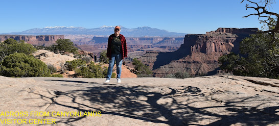
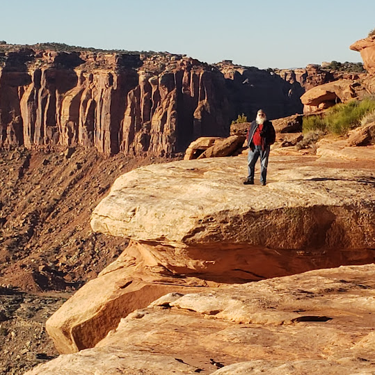
This is where the hike really begins. The hike went out to the point crossing the rock formation so that hikers can see the canyon from both sides. Carol and I are secure in who we are, but can be uncomfortable with heights, so it was a stretch to walk to the edge and look down, we both tried it anyway.

Yep, Looking Over the Edge
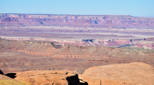
I did take pictures looking out over into the canyon as well. It was breathtaking to see the formations looming upward from the basin floor. It was hard to tell that the Colorado River was flowing through the valley.
This was just one side of the canyon, let us see the other side of the canyon as we made our way to the point. There is a road at the bottom of the canyon that runs the entire length of the canyon, about 100 miles.
But, before I show you the other side, here are some more small formations as we worked our way across the big formation.
Back Side of Above Formation
Ok, ok, I'll show you the second side of the canyon. It was amazing how different they were.
Here was one of the nature made foot stools for resting on:
Nature made a nice resting place at the "edge" of the trail, bench seating for six, and the views were phenomenal too.
Zoom of Above Photo
We rested for a little while before we hiked back to the parking lot.
This rock looked like a T-Rex head. How about the pointing finger:
Before we leave the canyon I would like to mention another similar difference, two rivers. One side was the Green River, the other side was the Colorado River.
We made it back to the truck and headed for the "Upheaval Dome". We didn't get to see the dome, parking was not available when we arrived. Part of the problem with parking was that it was also a picnic area, and all the areas were filled. It was not a loss though, as we were driving up we passed "Holeman Spring Canyon Lookout".
What a surprise when we passed the lookout... an island appeared out of nowhere:
When we turned around at "Upheaval Dome" and headed back to the "Holeman Spring Canyon Lookout", we stopped for lunch. Even just sitting around there are marvelous sites to see.
This is the Green River
This guy was across the road staring at us the entire time we were eating our lunch... I think he was waiting for crumbs to be dropped. I'm not sure if he is a mutt, or a dragon.
Lunch all done, and on to our next sightseeing stop. But first we meandered over to the Green River Lookout. It was hard to see a green river, but we tried.
Formation Called Turks Head
After our rest from sightseeing, it was time for another hike. This hike was suppose to be a short one, only a half mile round trip, which was good because our day was coming to a close, and we were getting tired. Our stop is "Mesa Arch". The first day we tried to see the arch there wasn't any parking, this trip, we made parking. The hike wasn't too bad, but there were a few areas that were slick because of the loose powdery sand on the rocks. The views were spectacular.
We spent a little time here. rested a bit, and hiked back to the car.
We started back home about 3:00 pm, and it was amazing how many people were just getting to the park. With the beautiful weather there were a lot of off road bicyclists hitting the trails. We made it out safely and back home for dinner.
We will be heading to Monument Valley.
















No comments:
Post a Comment